
Greenville Neighbors By Block
Public sources answer different questions about Greenville neighbors. County GIS is best for seeing the immediate parcel pattern. The property record supplies a selected parcel lead, while plats and deeds describe the land connection. Election and City map resources are geographic tools with strong privacy limits. A historic directory may help reconstruct an earlier Greenville block, but only for its stated edition. None of these sources is a complete list of people living near an address.
| Greenville source | Block detail it can show | Access |
|---|---|---|
| County Maps parcel polygons | Contiguous parcels, shared boundaries, PINs, roads, ZIP and map context | County map application |
| Real Property record | Selected-year tax parcel lead and distinct site or mailing fields where displayed | Public property form |
| ROD documents and plats | Recorded parties, legal boundaries, subdivision, and document references | Search, counter, copies, or historical holdings |
| County elections and polling map | Polling-place and district geography for an address | Official voter-facing and County routes |
| City neighborhood maps | Named planning and special-emphasis geography | City map and plan inventory |
| Library local-history sources | Time-specific addresses, maps, and community material | Exact volume, collection, or research request |
Greenville parcel boundaries are the reliable starting point because a nearby Greenville street name can include lots separated by a road, common area, commercial tract, or irregular geometry. The Greenville map establishes what is next to the selected land. It does not establish who is at home there.
Map Greenville Neighbor Parcels
The adjacent-parcel method makes a Greenville neighbors search specific and reproducible. Begin with a public address or known PIN in Greenville County Maps or Real Property Search. Resolve the Greenville result by the site-address number and street, then use the parcel boundary, not a street-name guess, to identify which tracts actually touch it. Record a PIN for each contiguous lot instead of copying a person into a block list.
- Find the starting Greenville parcel by public address or PIN and confirm its site-address number before proceeding.
- Use the GIS identify or query tools and zoom to the boundary. Note each contiguous parcel PIN, taking care with roads, common areas, and nonresidential lots.
- Open each Greenville property record separately. Keep its site address, mailing contact, owner or previous-owner label, deed reference, and plat reference distinct.
- Compare plat book/page and legal description when the block geometry is unclear or the work concerns a historic Greenville subdivision.
- For a whole named street rather than the immediate block, use the fuller Greenville street directory workflow.
This Greenville flow is intentionally narrow: address to parcel, parcel to adjacent PIN, PIN to individual public record, then document or plat context. It avoids treating a mailing field, a map label, or a deed party as a current household claim.
Greenville Neighbor Map Tools
Greenville County Maps is the official map route for a Greenville block. The County says the application can find addresses, real estate, roads, polling sites, schools, parks, and more. It can query, display, print, export, prepare real-estate reports with ownership, value, and history, and compare multiple aerial-photo years. For neighbors, use those capabilities to locate a parcel and understand its surrounding geography, not to assemble a contact list.
The Greenville parcel-layer schema explains why the map method is more dependable than a loose address search. Its published fields separate PIN or Tax Map #, owner and previous-owner labels, mailing address, site address, deed date/book/page, plat book/page, tax district, jurisdiction, legal description, subdivision, sale data, and values. Greenville's software transition also carries a warning that square footage, bedroom, bathroom, and half-bath data may not be current. Cross-check a Greenville field that matters with the map, deed, or custodian.
Note: Greenville Maps can place an address in its parcel setting, but a map and a property card do not verify a person's present location.
Greenville Neighbor Record Limits
The first Greenville property record is an address-led lead, not a block roster. Greenville Real Property Search has a tax-year selector visible from 1995 through 2027 and accepts Name, Street, Map No., Subdivision, or Sales Sheet No. The form permits only one nonempty criterion at a time. Search a street or map number, then move to the individual PIN rather than trying to combine fields for a broad Greenville neighbors result.
A tax owner, a tax-contact mailing destination, a recorded-document party, and a resident are four different claims. Greenville's separation of site and mailing data makes that distinction visible. The mailing location can be a post-office box, business location, a place outside Greenville, or the same physical address. Even when fields agree, the recorded date and source purpose should be considered before a conclusion is made.
That difference is the central local myth correction: a parcel record can support land research, while it cannot supply a complete account of Greenville neighbors or non-owner household members.
Greenville Block Plats Explained
Plat references can explain why a Greenville block looks different from a street address search. A plat is a recorded Greenville map or survey. A legal description identifies land by a lot, block, subdivision, or metes-and-bounds description. Together, they can bridge the selected Greenville parcel to the lots around it when a street number is missing from an older deed or when a transfer covers more than one tract.
- PIN or Tax Map #
- The Greenville parcel identifier used to connect the mapped tract with an individual property record.
- Plat book and page
- The recorded-map reference that may clarify lot lines, subdivision layout, and boundary relationships.
- Site address
- The physical Greenville property location, different from a tax mailing destination.
- Adjacent parcel
- A tract that shares a boundary after map review, not simply one with a similar street name.
Greenville's Register of Deeds materials list plats from 1951 to the present in the index and plat images from 1903 to the present. If the online material cannot reach the right period, the County Historical Records catalogue includes conveyance, plat, mortgage, probate, will, judgment, jail, sale, and writ material. The catalogue's web availability dates are not the dates of the records themselves.
Greenville Neighbor Voting Geography
Polling and district geography can give Greenville neighbors context without creating a roster. Greenville County Maps can find polling sites, and the County Registration and Elections page directs voters to official registration information, district material, and election resources. The State Voter Information route is designed for a voter to check that voter's own record, including registration, polling place, sample ballot, and voting history. It is not an open street browse.
The inspected MySCVotes form requires a county, first and last name, date of birth, last four Social Security digits, and CAPTCHA. South Carolina voter registration files contain sensitive information and have statutory confidentiality limits. The State provides a defined voter-list process for eligible purchasers, but its legal restrictions remain in force and it is not a reason to turn an address search into a list of Greenville neighbors.
The Greenville County Registration and Elections route is appropriate for current guidance on permitted records or a voter-facing question. For a geographical question, use the County polling map rather than attempting to identify individual voters.
Greenville County Registration and Elections is the local voter-information route shown below; it directs voters to the protected state-facing service.
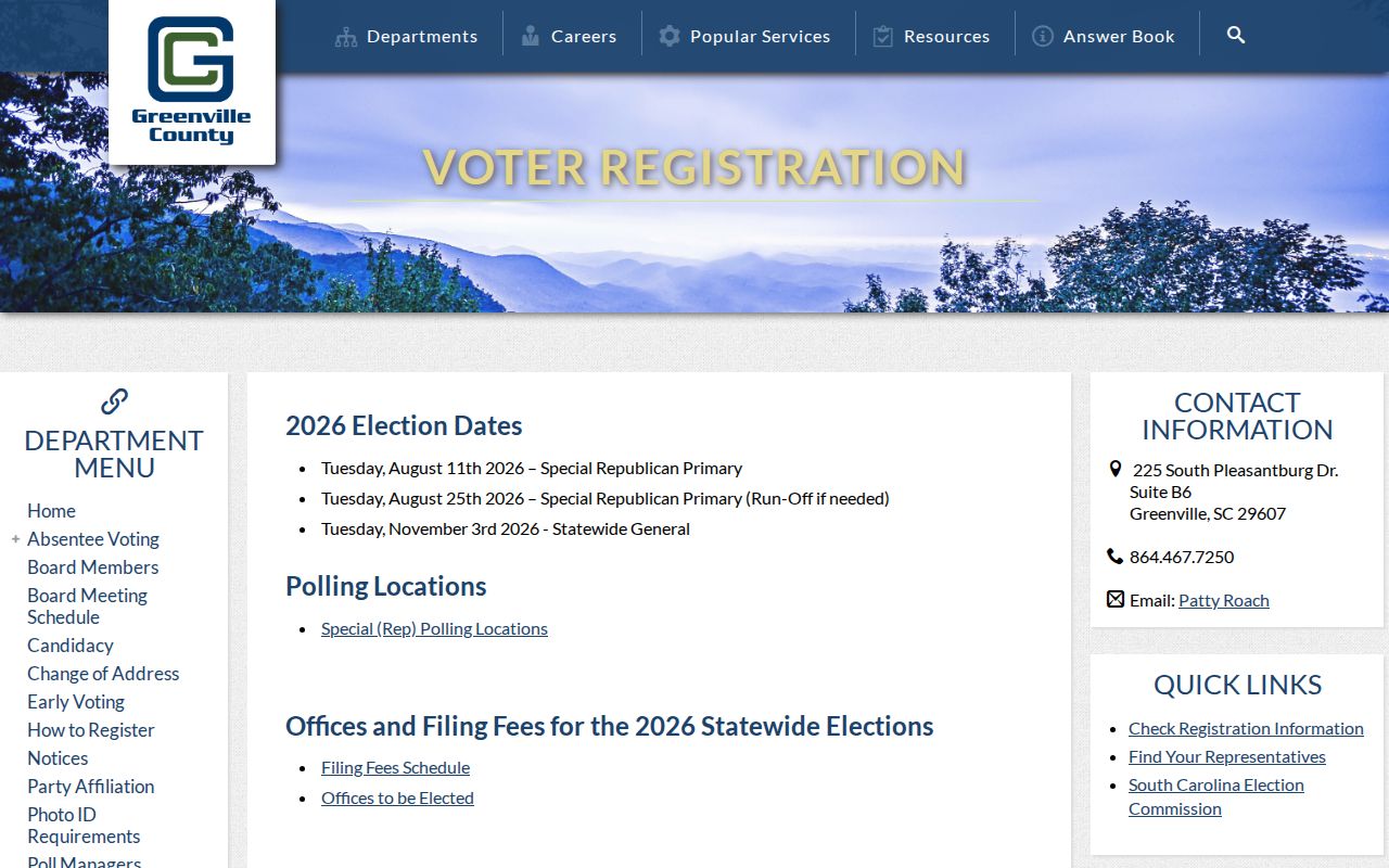
The Greenville election route can help a voter check personal registration information, while a neighborhood inquiry should stop at lawful district and polling-place geography.
Greenville Neighborhood Map Context
City neighborhood maps add named-area context to a Greenville block. The City's Greenville Neighborhood Maps and Master Plans inventory includes Brutontown, Greater Sullivan, Green Avenue, Greenline Spartanburg, Haynie Sirrine, Nicholtown, Pleasant Valley, Southern Side, Sterling, Viola Street, West End, and West Greenville. These are municipal planning or special-emphasis geographies. They can indicate which City map or plan covers an area, but they are not membership lists.
The research found no authoritative City umbrella directory of neighborhood-association members and no citywide public association roster. That absence is important. A property record should not be used to infer membership in an association, and a City plan should not be represented as an organization contact list. The appropriate use is to read the relevant Greenville map or plan as public area context.
| Greenville area resource | Appropriate block use |
|---|---|
| City Neighborhood Maps and Master Plans | Identify the named planning or special-emphasis geography that covers a parcel. |
| County Maps | Compare the parcel boundary, roads, polling context, and surrounding land geometry. |
| Digitize Greenville community collections | Research historic community context for Berea, City View, Five Forks, Green Avenue, Sans Souci, Mauldin, Simpsonville, Travelers Rest, and related collections. |
The City neighborhood-map inventory is the source for the named Greenville areas and plan geography.
Greenville Neighbors In History
A historic Greenville block needs dated evidence. The South Carolina Room and Greenville County Historical Society hold city-directory, map, newspaper, and local-history material, while Digitize Greenville offers collections involving communities, churches, schools, social clubs, mills, cemeteries, and residences. A historic collection can place a person or property in a past Greenville community. It cannot be turned into a present participant list.
For street-by-street context, use the exact volume. The 1921-22 Greenville directory contains a street-and-avenue guide, and later Hill and Polk runs are held for selected years. The Historic Society reports city directories from 1883 and selected Sanborn maps from 1920 to 1951. Pair a directory year with a dated plat, aerial image, census release, or recorded document. Do not assume continuity between volumes.
The Greenville County Library South Carolina Room provides the local-history and research-support fallback when a historical block does not appear in an online search.
Note: An old Greenville directory supports a time-specific listing only, so its year must remain attached to every address or name observation.
Greenville Neighbor Source Comparison
Official Greenville records and compiled neighbor tools serve different purposes. An official Greenville parcel map can show a public boundary and PIN. A tax or recorded-document system can show a land-related field or party where the custodian displays it. Unofficial compiled tools can mix older sources, omit their dates, and join similar names without showing the custodian or record context. For Greenville neighborhood history, the official source, exact record date, and access limitation are more useful than a broad profile claim.
| Source type | Useful Greenville question | Limit to keep in view |
|---|---|---|
| Official parcel and map records | Which tracts are contiguous and what land fields are publicly displayed? | They do not establish all current occupants. |
| ROD documents and plats | What recorded land reference connects an address to a legal description? | They do not provide a legal title opinion or household list. |
| Dated library sources | What did a particular Greenville directory or map show in its own year? | They are compiled and time-bound. |
| Unofficial compiled tools | What source should be verified with the actual custodian? | Dates, joins, and accuracy may be unclear. |
When Greenville public material is unavailable online, contact the correct Greenville office with the parcel, record type, date range, and format wanted. A Greenville records request is a way to seek an identified record, not a request for someone to identify people around an address.
Greenville Neighbor Privacy Limits
Greenville neighbors searches stop well before a household list. Greenville parcel, deed, and plat records concern land and recorded parties. They do not reveal non-owner household members, utility or delivery customers, DMV data, private communications, or a person's whereabouts. Court and vital records have separate confidential categories. Election records have protected fields, and the Address Confidentiality Program can shield participant addresses in election records.
South Carolina's Family Privacy Protection Act restricts certain use of personal information obtained from public bodies for commercial solicitation. Greenville ROD materials also provide a route to request removal of listed identity and account information from internet images while preserving the original official record. Qualifying current or former judges and certified law-enforcement personnel may seek specified web-address, cell, and tax-map protections under the state's 2026 privacy law.
Lawful use. Use Greenville block records for lawful property history, family history, civic context, record correction, or estate research. South Carolina law prohibits using public information to stalk, harass, threaten, intimidate, or harm another person.
A narrowly described Greenville County FOIA request can seek a nonexempt identified record from its custodian. The office must still apply the relevant exemptions, confidentiality rules, and redactions.